Water Reservoir
Health Check
Current water levels
Lake Mead & Hoover Dam
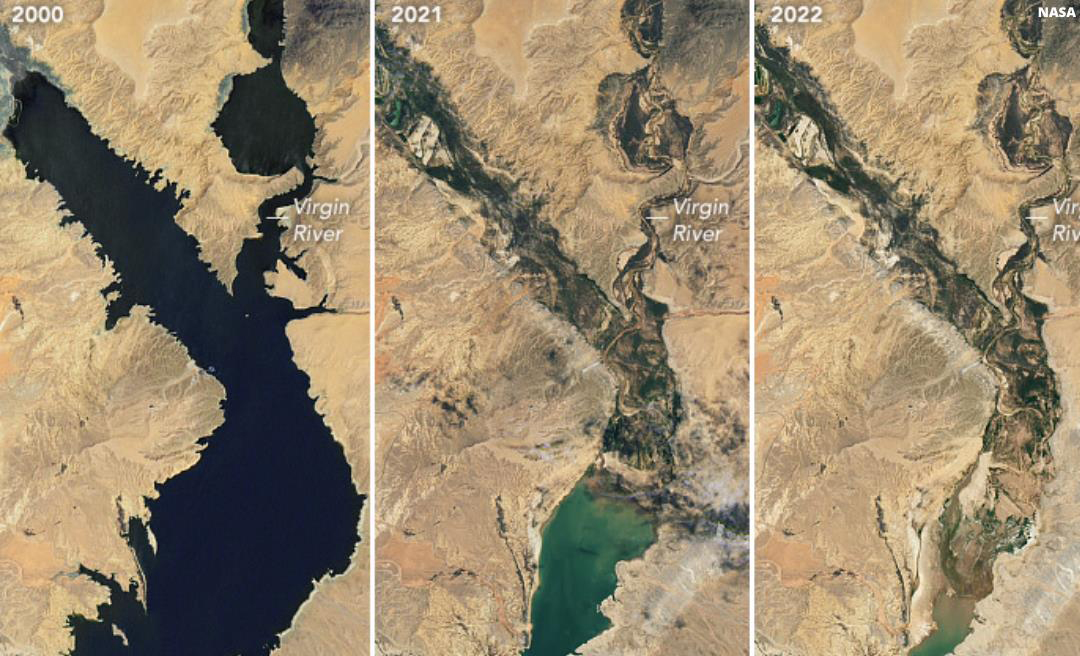
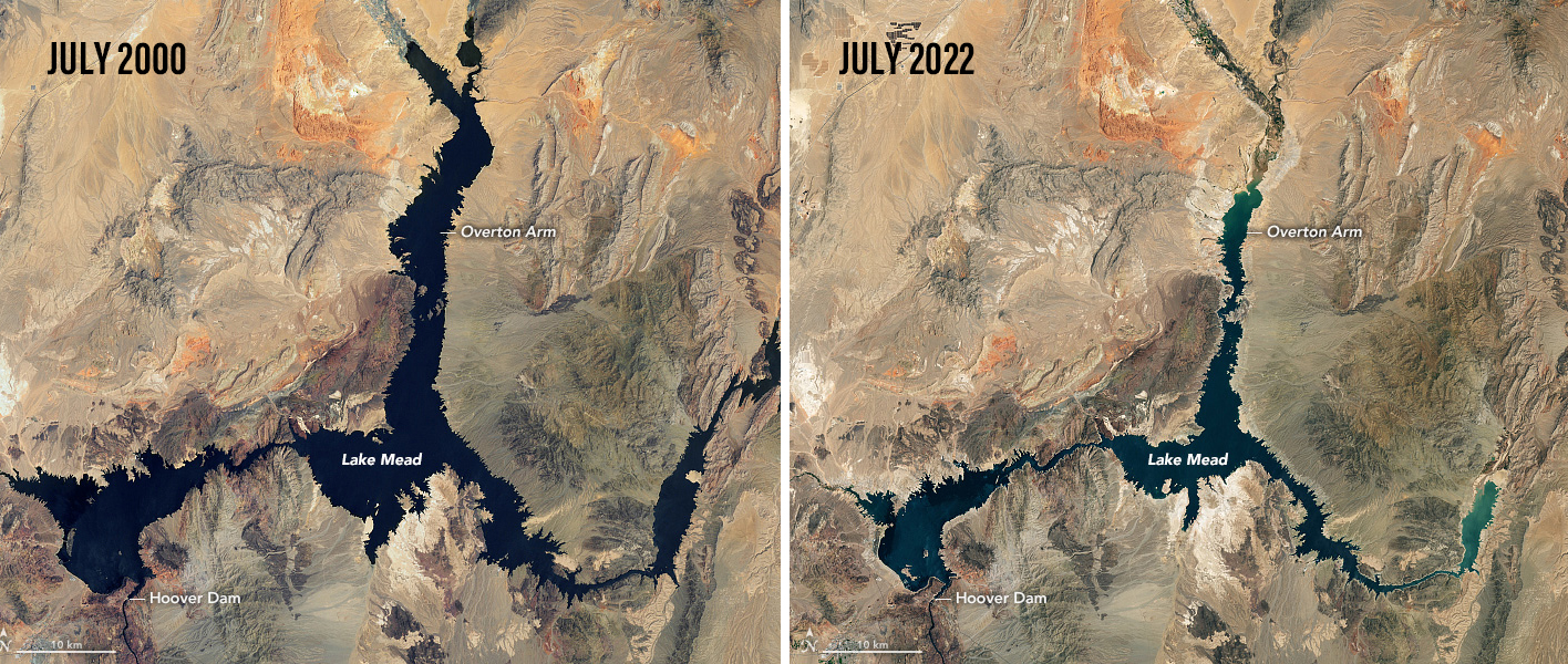
Lake Mead is a reservoir formed by the Hoover Dam and is located in the states of Nevada and Arizona, 24 miles east of Las Vegas. It is the largest reservoir in the US in terms of water capacity.
At maximum capacity, Lake Mead is 112 miles (180 km) long, 532 feet (162 m) at its greatest depth, has a surface elevation of 1,229 feet (375 m) above sea level, has a surface area of 247 square miles (640 km2), and contains 28.23 million acre-feet (34.82 km3) of water.
In the area that was chosen to become Lake Mead, native Americans referred to as Ancestral Puebloans were settled in the area. Many archaeological sites were submerged by the creation of Lake Mead, including the most representative, which is referred to as the “Lost City”.
The lake was named after Elwood Mead, who was the commissioner of the U.S. Bureau of Reclamation from 1924 to 1936, during the planning and construction of the Boulder Canyon Project that created the dam and lake.
Lake Mead was established as the Boulder Dam Recreation Area in 1936, administered by the National Park Service. The name was changed to the Lake Mead National Recreation Area in 1947.

Mead Changing Water Levels
Highest Level: The highest point Lake Mead reached was 1,225 feet above sea level in July 1983.
Lowest Level: The lowest level recorded since the lake began filling in the 1930s was 1,040 feet in July 2022.
Full Capacity: Lake Mead is considered at full capacity when the water level reaches 1,220 feet above sea level, but it can hold a maximum of 1,229 feet.

Lake Powell & Glen Canyon Dam
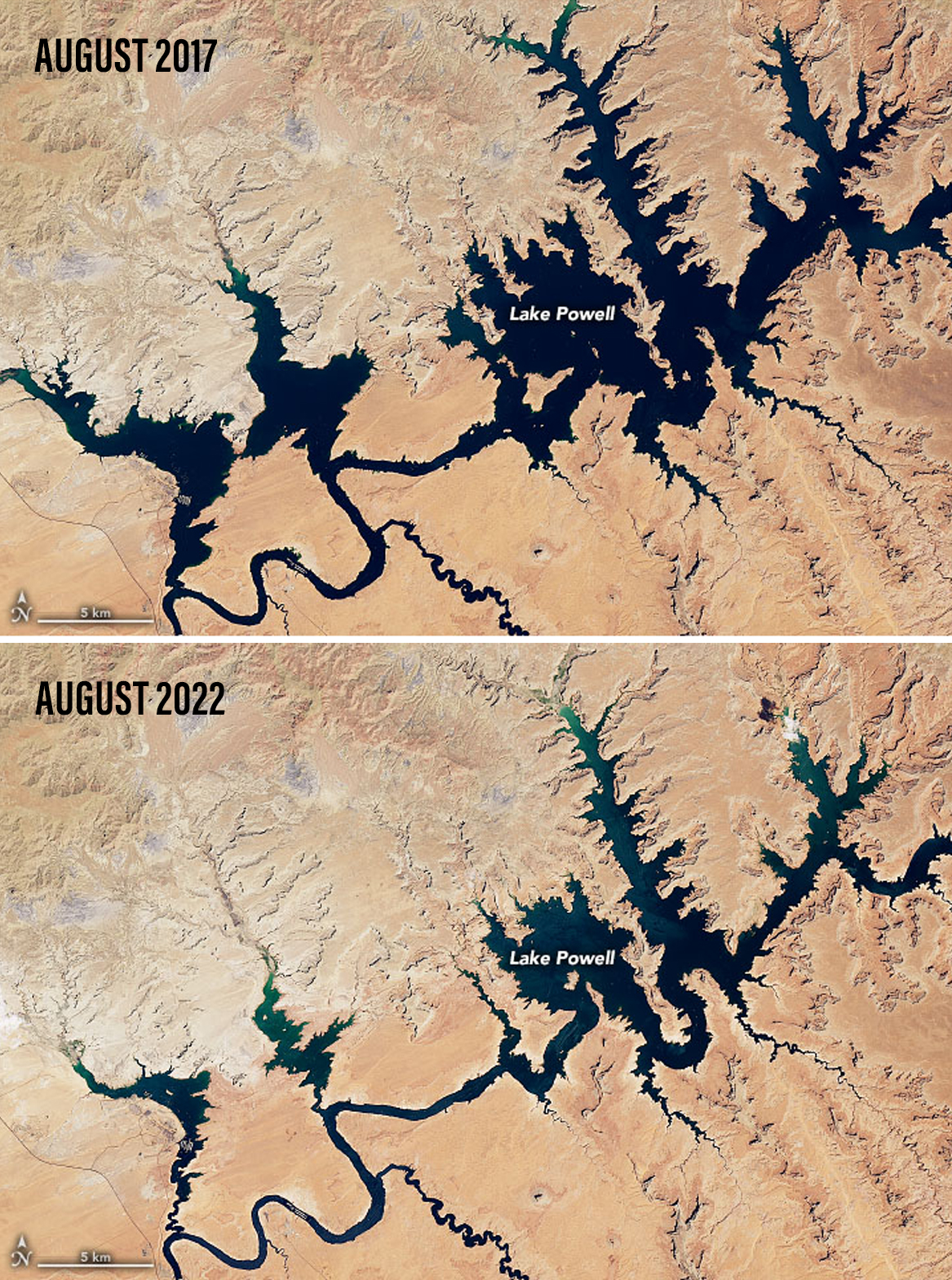
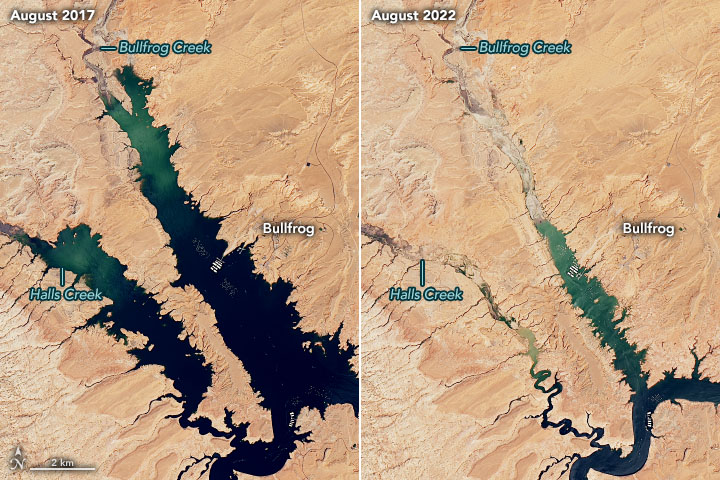
Lake Powell was created with the construction of the Glen Canyon Dam. The reservoir is named for John Wesley Powell, a Civil War veteran who explored the river via three wooden boats in 1869. Glen Canyon Dam was built to manage flows downstream. Lake Powell lies primarily in southern Utah, with a small portion in northern Arizona.
The storage provided in Lake Powell is absolutely critical for the ability of the entire Colorado River Basin system to supply water for upwards of 40 million people in these seven basin states and Mexico. The lake is also a major recreation area, known for magnificent sandstone canyons and rock formations.

Powell Changing Water Levels
Highest Level: The highest water level at Lake Powell was recorded on July 14, 1983, when the lake rose to 3,708.34 feet above sea level during one of the heaviest Colorado River floods in recorded history.
Lowest Level: Lake Powell reached its lowest level in winter of 2023 when it was at 3,519.92 feet above sea level.
Full Capacity: Lake Powell is considered at full pool when the water level reaches 3,700 feet.

How
Snowpack
Affects Reservoir Health
Snowpack in the Rocky Mountains significantly impacts reservoir levels by acting as a natural water storage system that gradually releases water into rivers and streams, ultimately filling reservoirs. When snow melts in the spring, it replenishes reservoir levels, which are crucial for providing water for various purposes, including hydropower, irrigation, and drinking water. Changes in snowpack, like a decrease in snow cover, can lead to reduced reservoir levels and potentially impact water availability.
- Snowpack in mountainous areas acts as a natural reservoir, storing water during the winter months and gradually releasing it as snow melts in the spring and summer.
- The melting snow contributes to spring runoff, which is the primary source of water for many reservoirs.
- The runoff from snowmelt flows into rivers and streams, eventually filling reservoirs that are designed to store water for later use.
- Reservoirs play a crucial role in providing water for various needs, including hydropower generation, irrigation for agriculture, and drinking water for communities.
- Reduced snowpack, whether due to less snowfall or earlier melting, can lead to lower reservoir levels, potentially affecting water availability and posing challenges for drought planning.
- Organizations like Denver Water and the National Resources Conservation Service (NRCS) monitor snowpack through various methods, including manual measurements and automated sensors at SNOTEL stations, to assess water availability and its impact on reservoir levels. SNOw Data Assimilation System (SNODAS) is a modeling and data assimilation system developed to provide the best possible estimates of snow cover and associated parameters to support hydrologic modeling and analysis.